By STAN  KASPRZYK
FlightLog Archive
∟Aircraft Flown
Viewing The Eclipse By Air - Aug 2017
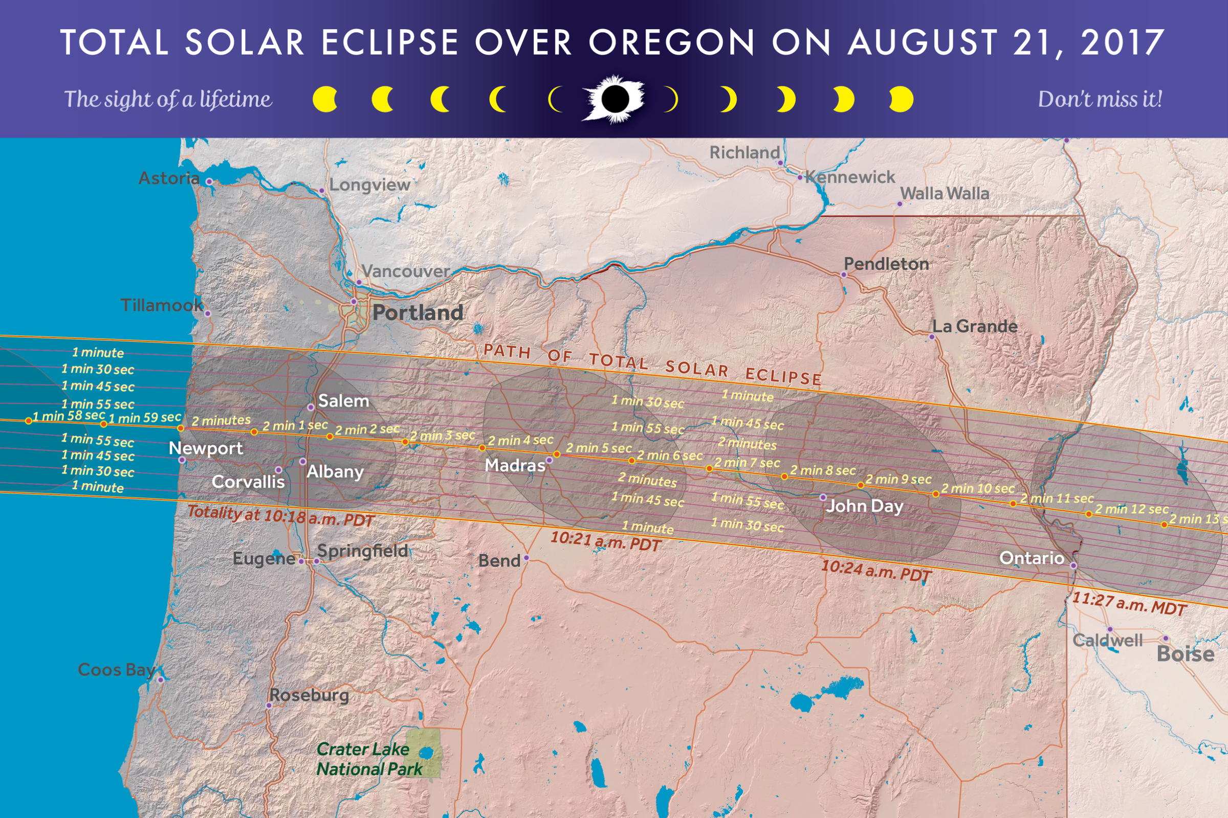

As the time neared for the highly anticipated 2017 total solar eclipse, Ma and I were still debating whether to try to view it from an Oregon airport along the totality route, or from the vantage point of the cockpit. We considered Madras and Salem, OR, which were both along the line of totality, but they filled up quickly and the idea of tons of airplanes on a dusty field wasn't too appealing.
We decided to view the eclipse from an airborne perspective, planning to lessen traffic conflicts by choosing a medium altitude (6500 or 7500 feet), and using our Lynx ADS-B traffic information to provide situational awareness on the other airborne eclipse viewers. As the 21st of August neared, weather forecasters were predicting excellent VFR flying and viewing conditions both at our Renton, WA launch field, and along the line of totality extending from the Oregon coast to a line between Salem and Albany, OR, where I planned to cruise.
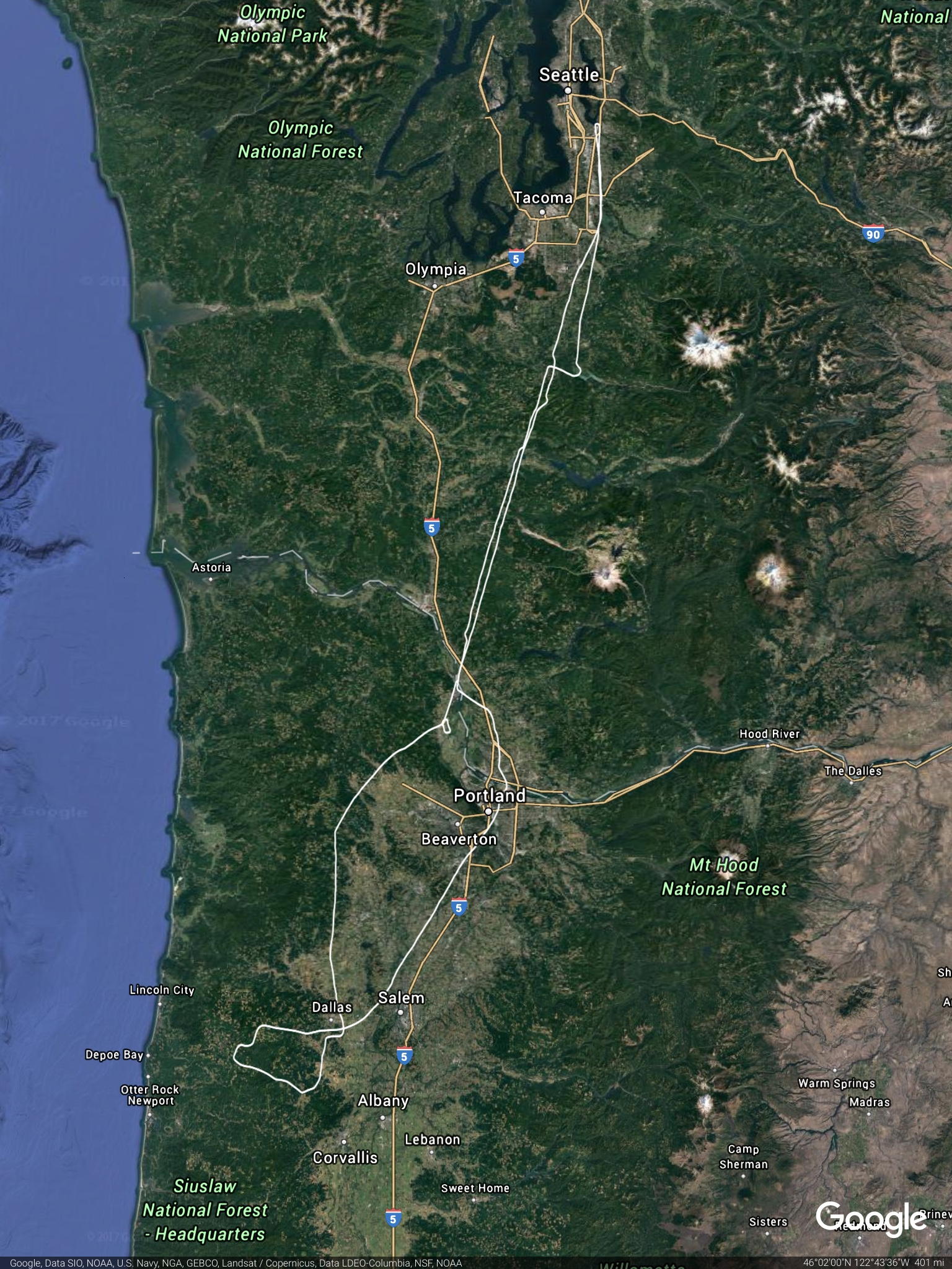
As August 21st dawned, our plan was to launch from Renton to Scappoose, OR, then wait on the field until the timing was right to hit the line of totality as it moved in from the Pacific. We launched in our Warrior at 8:10AM, and started our planned first leg to Scappoose. Seattle Center was still providing flight following in the Seattle area, so we used them and our ADS-B to get a feel for the number of aircraft heading to the eclipse zone, which was definitely increasing as we continued south. Since we had over four hours of fuel onboard, we decided to skip the Scappoose stop and remain airborne in Oregon, allowing better positioning along the totality line.
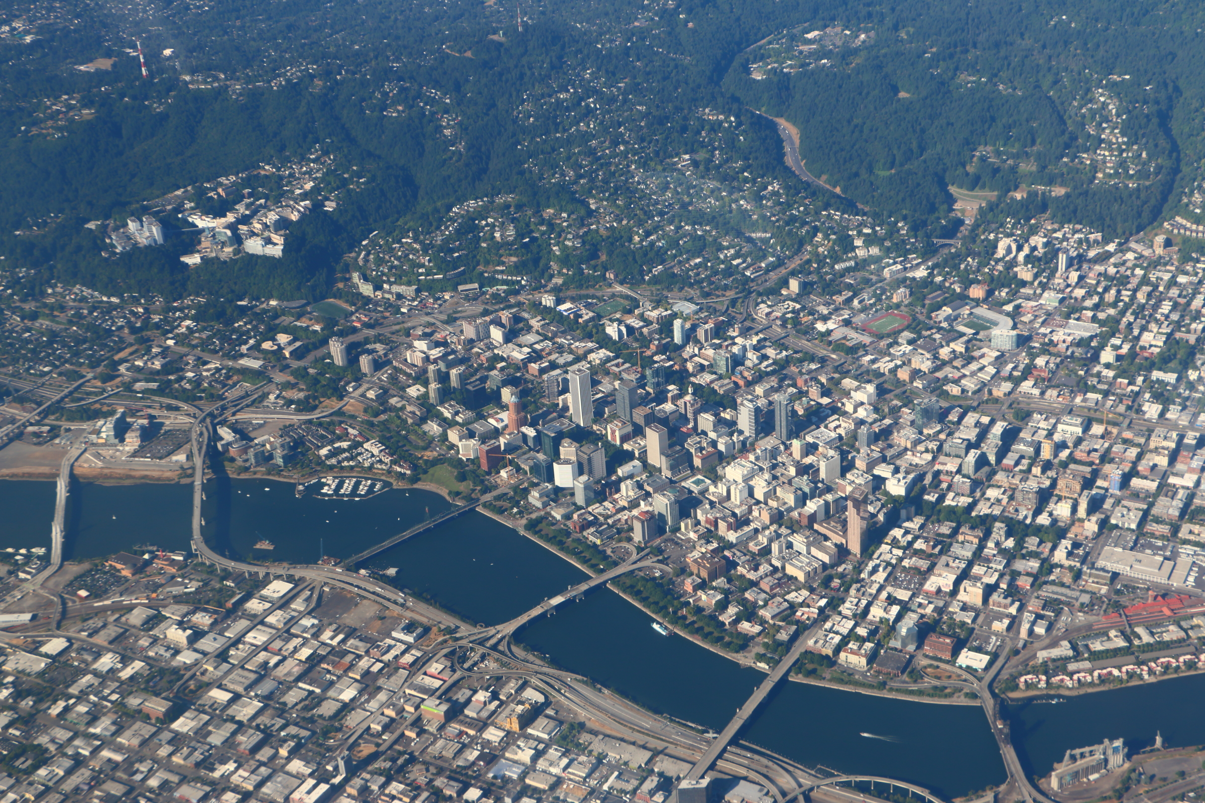
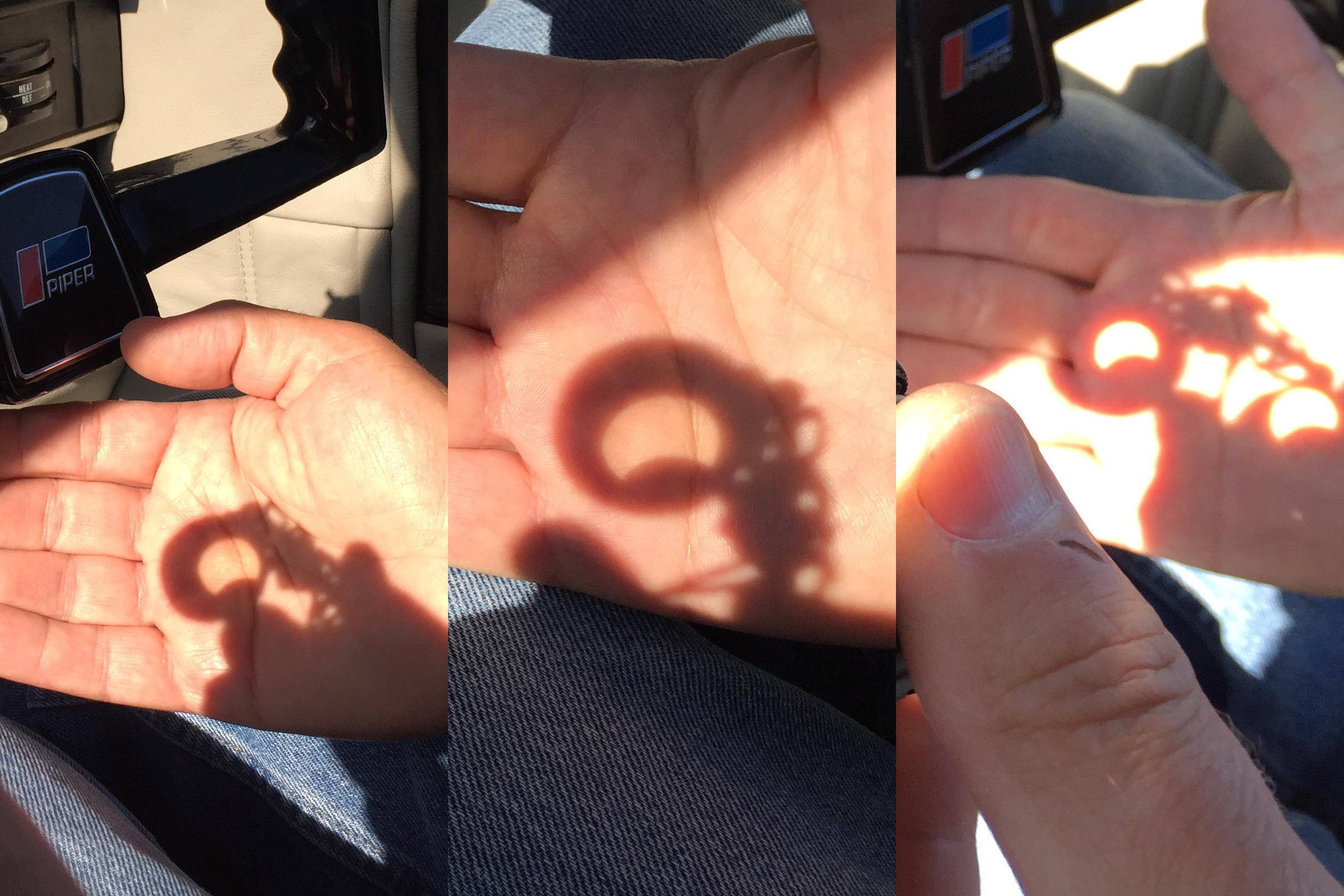
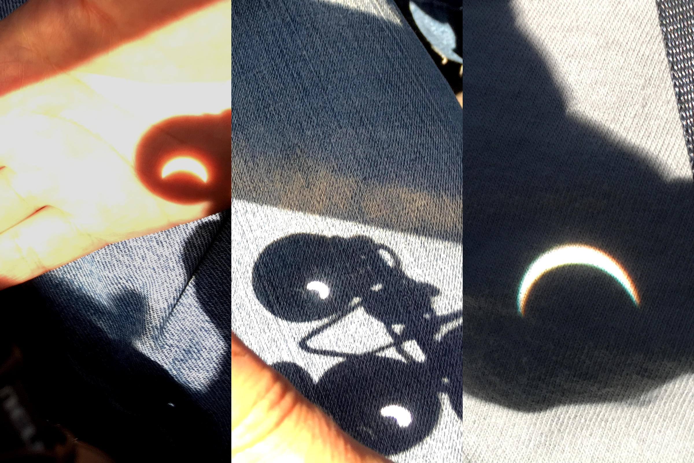
As we neared Scappoose, Portland Approach was sounding very busy on their frequency, and asked us if we could divert east temporarily for departing Portland International traffic, then cleared us to fly directly over the PDX runways on our cruise south, providing nice views of downtown Portland as we continued southbound. Once we passed south out of Portland Approach's area of responsibility, we expected to continue flight following with Seattle Center. However, Portland Approach advised us that Seattle Center was completely swamped, and wasn't accepting any flight following along the totality route. We did join the Seattle Center frequency for the area, just to keep our awareness up, and it was amazing as the eclipse approached, how many aircraft tried to come up on frequency for flight following, but were all denied. We maintained our 7500 foot altitude, since most of the other aircraft with 10 miles seemed to either be lower, around 2500 feet, or higher, around 10,500 feet. Circling extremely high above, pulling circular contrails, were two aircraft also positioning for the eclipse, with an altitude readout on our ADS-B display of 46,975 feet! No deconfliction problem with them. Even though the lighting seemed the same, we started seeing the moon take a bite out of the sun, while projecting the image through binoculars on to our hand or leg.
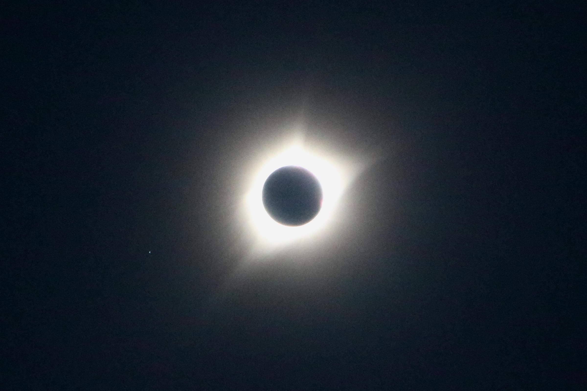
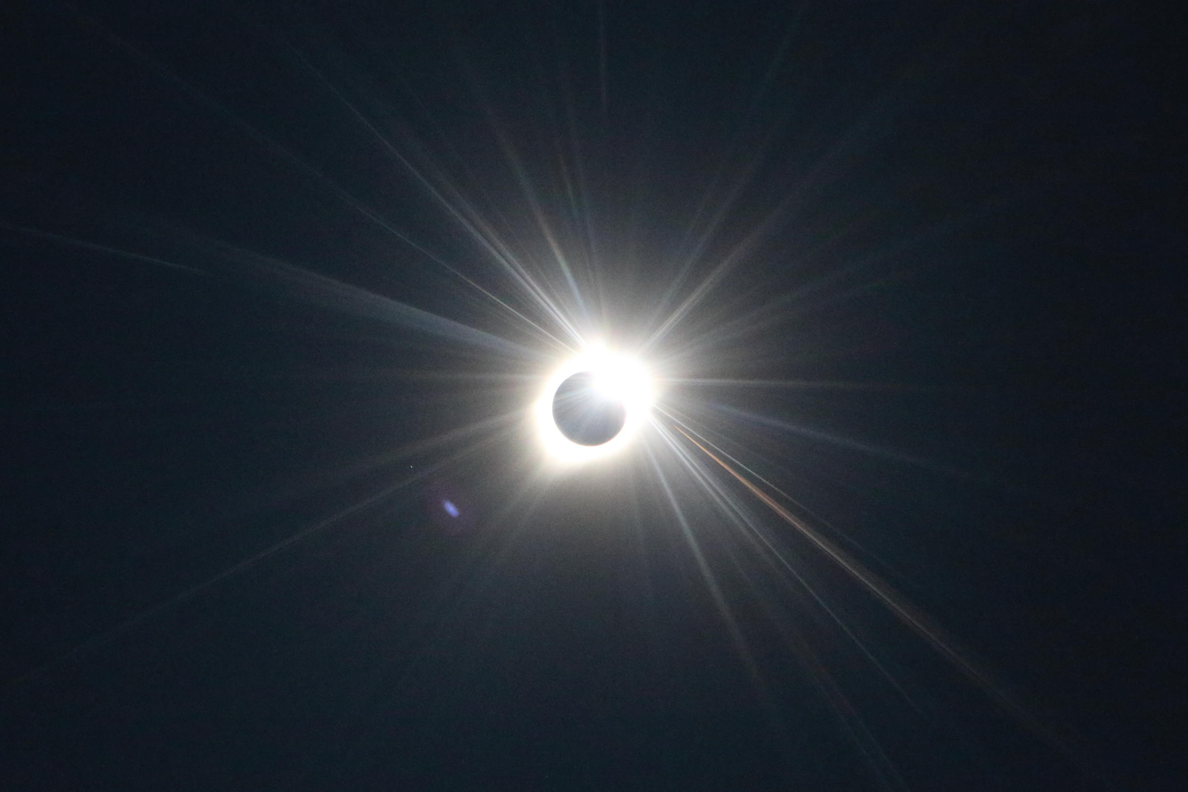
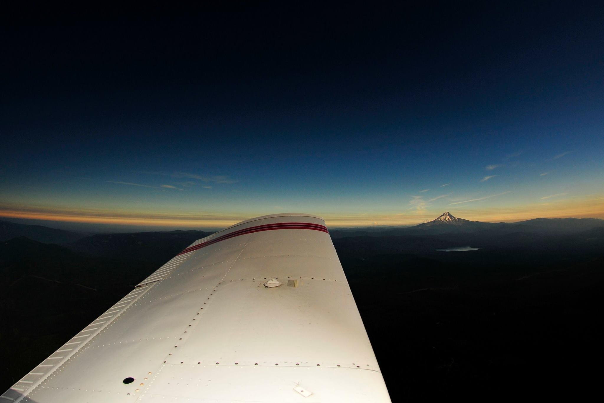
Our timing was great, since we arrived in the band of totality at 10:00AM, and set up a track toward the Pacific coast, and planned a turn back east around 10:15AM, with the total eclipse scheduled to center on us at 10:18AM. As the moon took a larger and larger bite out of the sun, our eyes started adjusting automatically, which was most noticeable as I had to keep turning the Garmin and iPad displays dimmer. We set up on a short westerly track, and had an amazing view as it appeared a black cloth was getting draped over the ocean, and we could see the darkness rapidly approaching us. Like a light being switched off, we were in totality, and noticed a chorus of fireflies all around us, with the position and strobe lights of the surrounding aircraft appearing in all directions. Since we could now look directly at the sun, I was amazed at how bright and defined the corona was, and I was able to take a number of photos with no filter. It was a very ethereal view all around, with the corona above, darkness all around, but still a dim glow highlighting Mt Hood and Mt Jefferson in the distance to the east. Just as we were feeling that we were on another planet, the two minutes of totality ended, the switch was flipped, and the lights were back on. I was able to take one 'diamond ring' photo just as the sun peaked out, but the brightness then increased very quickly, and I began to track the aircraft around me to ensure safe separation.
Keeping a sharp eye out for the closest traffic, we began a slow descent to the north, exiting the main gaggle of aircraft and letting down for a refueling stop at Scappoose. We changed from the still busy Seattle Center frequency, and rejoined Portland Approach, who were now vectoring passing Alaska and Horizon airliners who had also joined the orbiting crowd for eclipse views. We descended into normally quiet Scappoose, and joined at least nine other aircraft either returning home or also refueling after their airborne eclipse viewing. After a quick refueling and launch northbound, we were still impressed with the amount of mid-day air traffic cruising back from eclipse central.
After talking with a number of pilots who had descended into Madras, Salem or other Oregon airports along the route, we became convinced that we had made the right choice - Eclipse by Air!
Epilog
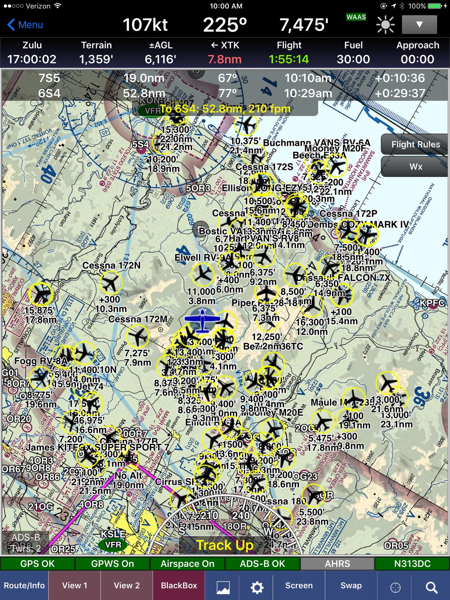
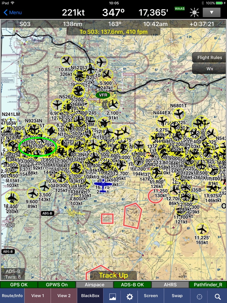
In 2018, while reviewing a Van's Air Force website, I stumbled upon a screen shot from another WingX user, Chuck Newman, flying RV-8 N828RV, who got an amazing shot of the traffic in the Oregon skies at the time of the eclipse. There in the midst of hundreds of tracks, is the ID for our Warrior, N313DC!